A Summary on Hiking Locations in Washington State
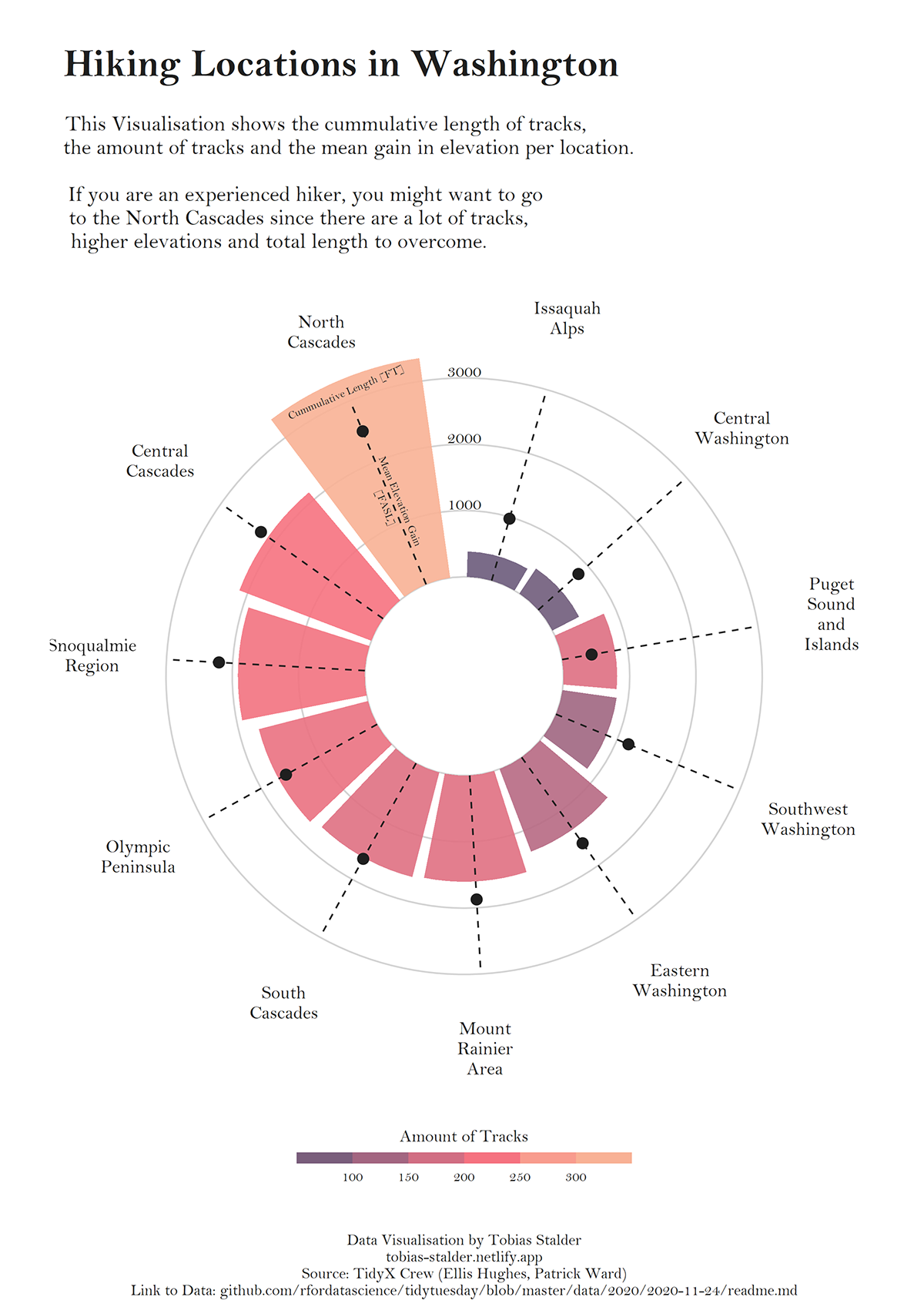
This datavisualisation summarises Washington as a hiking environment in a radial bar chart. Each hiking location was attributed to one bar showing the cumulative length of hiking tracks as bar height, the number of individual tracks in color and the mean elevation gain of these tracks with a dot-slider.
A detailed description and manual of how I created this datavisualisation was published in the R-graph-gallery. The crew behind TidyX recorded a screencast called "Polar plots and the purpose of data viz" where they discuss the plot in detail (linked below).
Data | Washington state hiking, submitted to #TidyTuesday R for data science by TidyX
Tools | R, ggplot2

